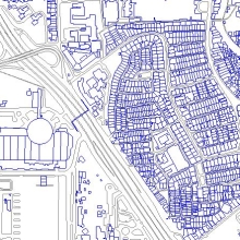
GIS database provides the very core layer of vector features required to support any geospatial query, analysis and modeling.
Governments and institutions around the world have recognized and accepted the power of GIS in helping them plan, model and manage ever complex issues facing the modern world. The maturity and acceptance of GIS and remote sensing technologies have resulted in greater demand for highly accurate and complete GIS databases.
GIS Database
Whether it’s for location based services (LBS), network infrastructure planning, route
planning, fleet management, town planning, environmental management and the ever sophisticated defense and homeland security applications, GIS databases play a key and vital role in the entire systems setup. Digital GIS database is one of the key component in the ever complex world that we try to capture, update, and to perform a wide range of geospatial modeling and analysis on. These highly sort after geographic information system (GIS) digital maps are critical to many of today's geospatial applications.
These GIS databases are derived from a combination of detailed ground surveys, extraction from newly acquired very high resolution satellite imagery and other commercially available data sources.